 |
 |
 |
 |
![]()
![]()
| VOLUMETRIC
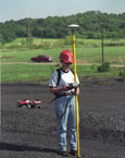
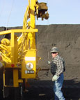
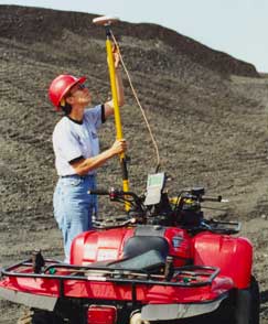
SURVEYS Volumetric surveys of coal stockpiles, as well as fly-ash landfills, are efficiently performed via GPS survey techniques. MIKON utilizes dual-frequency, real-time GPS receivers. Data points are collected on grid spacing commensurate with localized grade variations throughout the stockpile (typically 25 feet or less), supplemented by shots at prominent grade breaks. Because GPS signals are not affected by cloud cover, these surveys can be performed in virtually any weather conditions. This eliminates the weather-related scheduling difficulties that often arise when utilizing aerial photography. Our turnkey volumetric services provide a quality product at affordable prices. Our field crews are staffed with project engineers responsible for interfacing with the client and managing the project from start to finish. |
MIKON
CORPORATION | 4414 B South 40th St., St. Joseph, MO 64503 |
Phone:
816-364-2890 | Fax: 816-364-2126 |